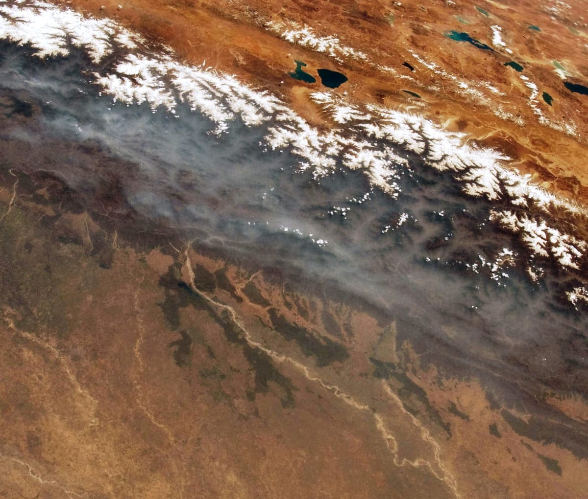
India has high young mountains in the north, wide river plains in the middle and an old hard plateau in the south. A sandy desert lies in the west, with coastal plains and islands at the edges. Rivers born in the Himalaya flow all year; rivers of the plateau depend on rain. Exams ask where rivers rise, where they meet the sea, and which dams and lakes lie on them.
On this page you will learn:
- The six physical divisions of India
- The three Himalayan ranges, the Trans-Himalaya, peaks and passes
- Plains, plateau, the Western and Eastern Ghats, the Thar, coasts and islands
- The Indus, Ganga and Brahmaputra systems
- Peninsular rivers: east-flowing and west-flowing
- Lakes, waterfalls and dams
The six physical divisions
Rule in one line: mountains, plains, plateau, desert, coasts, islands — six in all.
Young fold mountains in the north, with the Trans-Himalaya and the hills of the north-east (Purvanchal).
Built of silt laid by the Indus, Ganga and Brahmaputra. Very fertile and thickly peopled.
The oldest part of India, of hard old rocks. Rich in minerals.
The Thar, west of the Aravalli hills.
Narrow strips along the Arabian Sea and the Bay of Bengal.
Lakshadweep in the Arabian Sea; Andaman and Nicobar in the Bay of Bengal.
NCERT groups India's land into these six physiographic divisions.
The Himalaya: ranges, peaks and passes
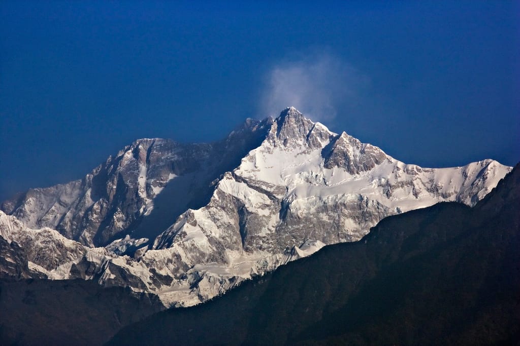
Rule in one line: three parallel ranges — Himadri (highest), Himachal (middle), Shiwalik (lowest, outer).
| Range | Height | Remember it for |
|---|---|---|
| Himadri (Greater or Inner Himalaya) | Average about 6,000 m | Most continuous range; all the highest peaks; always under snow |
| Himachal (Lesser Himalaya) | 3,700–4,500 m | Pir Panjal, Dhauladhar and Mahabharat ranges; Kashmir, Kangra and Kullu valleys; hill stations |
| Shiwalik (Outer Himalaya) | 900–1,100 m | Loose gravel and silt; flat valleys called duns, such as Dehra Dun |
| Section (west to east) | Between the rivers | Peaks to remember |
|---|---|---|
| Punjab Himalaya | Indus – Sutlej | Kashmir and Himachal ranges |
| Kumaon Himalayas | Sutlej – Kali | Nanda Devi, Kamet |
| Nepal Himalaya | Kali – Teesta | Everest, Kangchenjunga |
| Assam Himalaya | Teesta – Dihang (Brahmaputra) | Namcha Barwa at the eastern end |
| Pass | Where | Why it is asked |
|---|---|---|
| Zoji La | J&K – Ladakh | Srinagar–Leh road |
| Khardung La | Ladakh | Leh to the Nubra valley |
| Lanak La | Ladakh (Aksai Chin) | On the border between India and China |
| Baralacha La | Himachal (Lahaul) | Chandra and Bhaga rise near it; they join to form the Chenab |
| Rohtang | Himachal | Kullu to Lahaul; the Beas rises at Beas Kund nearby |
| Shipki La | Himachal (Kinnaur) | The Sutlej enters India here from Tibet |
| Lipulekh | Uttarakhand | Route of the Kailash–Mansarovar yatra |
| Nathu La | Sikkim | Old trade route to Tibet |
| Bomdi La | Arunachal Pradesh | Route to Tawang |
Karewas are flat beds of clay and silt left by an old lake in the Kashmir valley. They are good for growing Zafran, the local saffron of Kashmir.
Plains, plateau, desert, coasts and islands
Rule in one line: the plains are young river silt; the plateau is old hard rock.
The Northern Plains spread over about 7 lakh sq km. They are an aggradational plain: built up layer by layer from the silt that the Himalayan rivers lay down. From the hills down to the rivers, they have four belts:
- Bhabar — a narrow belt of pebbles at the foot of the Shiwaliks. Streams sink into it and vanish.
- Terai — the streams come up again; wet, marshy and once thickly forested.
- Bhangar — older alluvium on higher ground, with lime nodules (kankar).
- Khadar — newer alluvium of the flood plains, renewed almost every year. The most fertile.
The Peninsular Plateau is a table-land of old rocks. The Narmada splits it into two parts. North of it are the Central Highlands — the Aravalli, Malwa, Bundelkhand, Baghelkhand and Chota Nagpur plateaus. South of it is the Deccan Plateau, edged by the Western and Eastern Ghats.
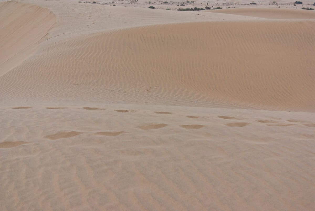
West of the Aravalli. Crescent dunes (barchans). The Luni is its only large river.
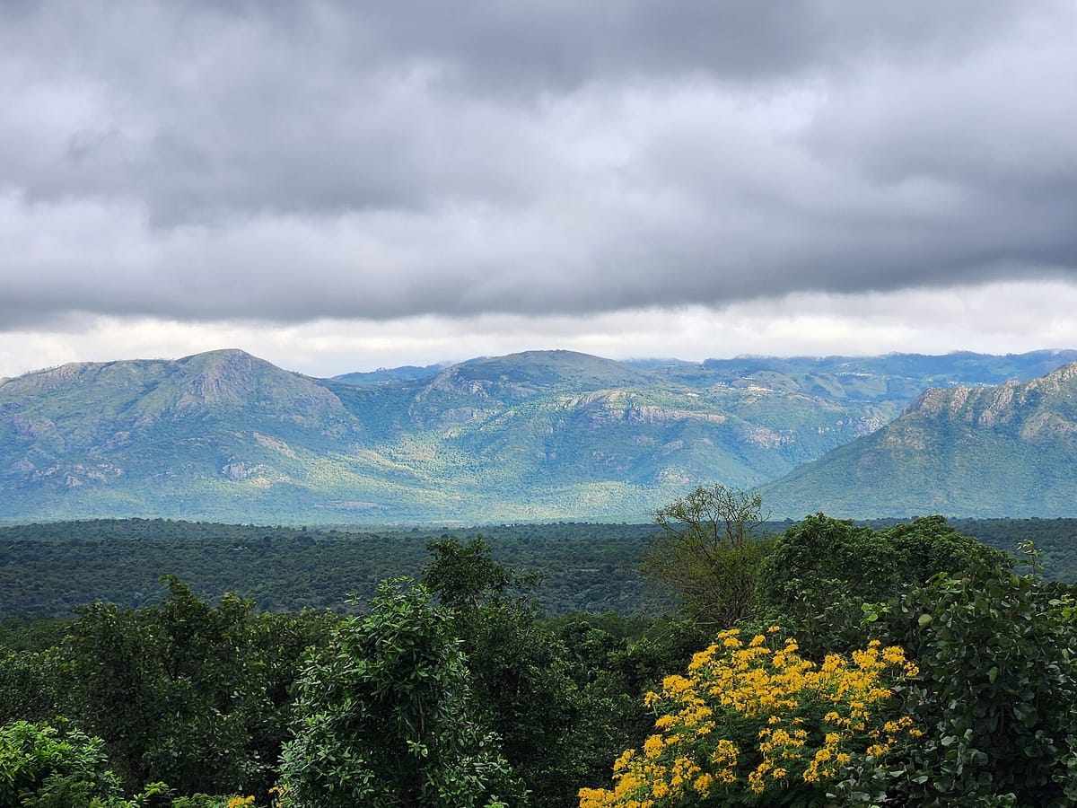
Narrow plain, north to south. Malabar (Kerala) has backwaters (kayals).
Wide plain with big river deltas. Chilika (Odisha) is India's largest salt-water lake.
Lakshadweep is made of coral. Barren Island (Andaman) is India's only active volcano.
Divisions 4, 5 and 6 at a glance.
Himalayan rivers: Indus, Ganga, Brahmaputra
Rule in one line: Himalayan rivers are fed by snow and rain, so they flow all year.
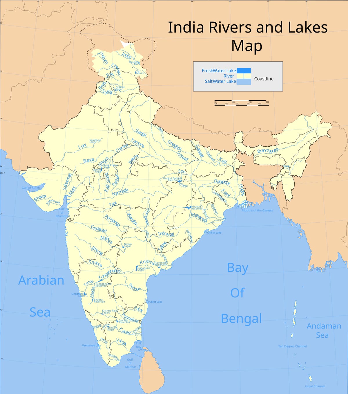
| River | Where it rises | Key facts |
|---|---|---|
| Indus | Tibet, near Lake Mansarovar | Enters India in Ladakh; reaches the Arabian Sea in Pakistan |
| Sutlej | Rakas Tal near Mount Kailash, south-western Tibet | Enters India at Shipki La; Bhakra dam |
| Beas | Beas Kund, near Rohtang Pass | Flows through the Kullu Valley; joins the Sutlej at Harike |
| Ravi | Kullu hills, west of Rohtang | Flows through the Chamba valley |
| Chenab | Chandra and Bhaga, near Baralacha La | Largest tributary of the Indus |
| Jhelum | Spring at Verinag, foot of the Pir Panjal | Flows through Srinagar and Wular lake |
| Ganga | Bhagirathi from the Gangotri glacier (Gaumukh) | Bhagirathi + Alaknanda at Devprayag; about 2,525 km long |
| Yamuna | Yamunotri glacier | Joins the Ganga at Prayagraj (Allahabad) |
| Brahmaputra | Tibet, east of Mansarovar — outside India | Called the Yarlung Tsangpo in Tibet; enters Arunachal as the Siang (Dihang) |
The Jhelum, Chenab, Ravi, Beas and Sutlej meet in Pakistan as one stream, the Panjnad ('five rivers'). It joins the Indus near Mithankot. So the Indus itself is not one of the five.
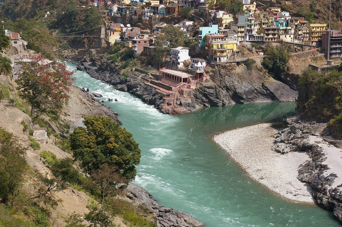
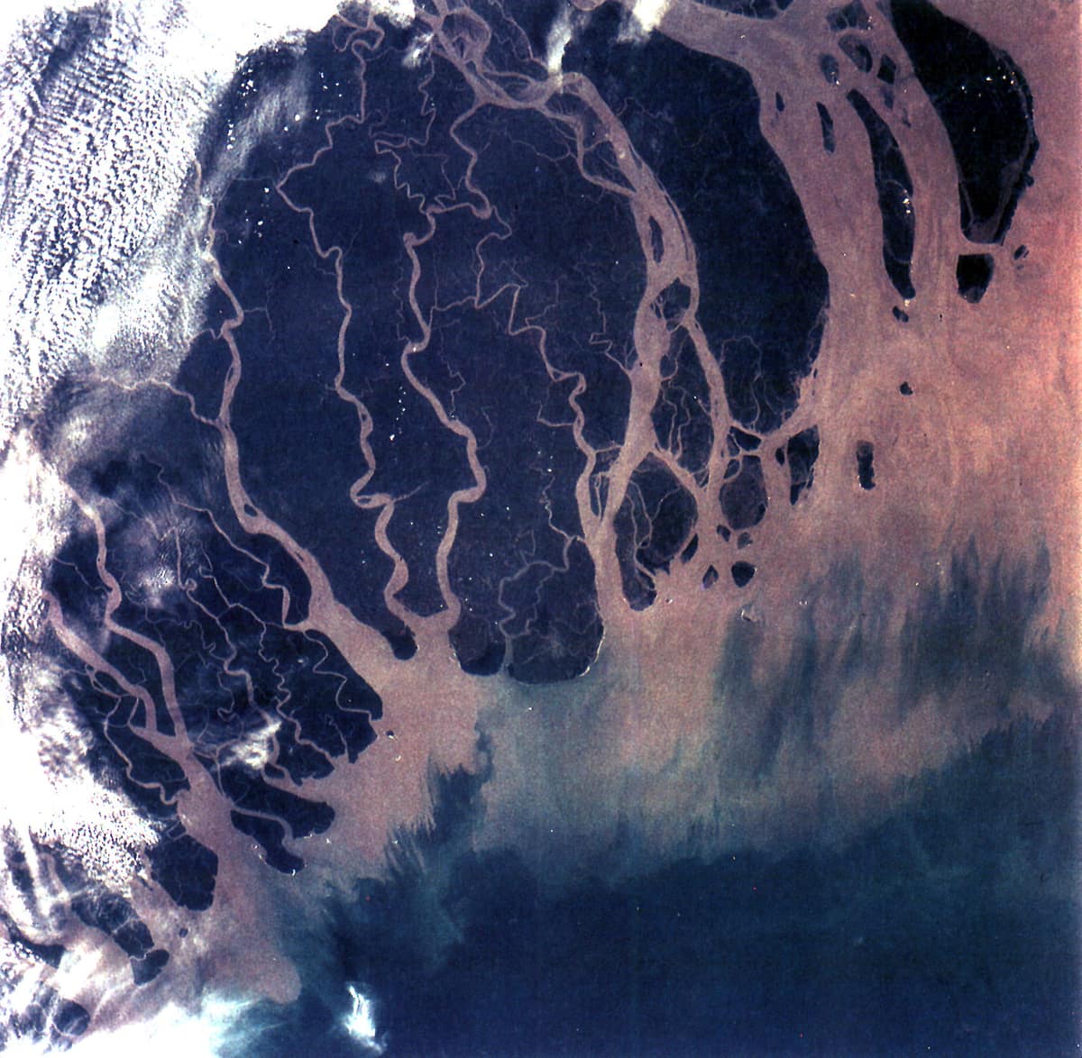
The Ganga gets the Ghaghara, Gandak and Kosi from the Himalaya (left bank) and the Son from the plateau (right bank). The Kosi floods so often that it is called the 'Sorrow of Bihar'. At Farakka the Ganga splits: the Bhagirathi–Hooghly flows south through West Bengal, and the Padma enters Bangladesh. There it meets the Brahmaputra, and together they build the delta.
Peninsular rivers: east-flowing and west-flowing
Rule in one line: the Western Ghats are the water divide — most rivers run east to the Bay of Bengal.
| River | Rises at | Falls into | Remember |
|---|---|---|---|
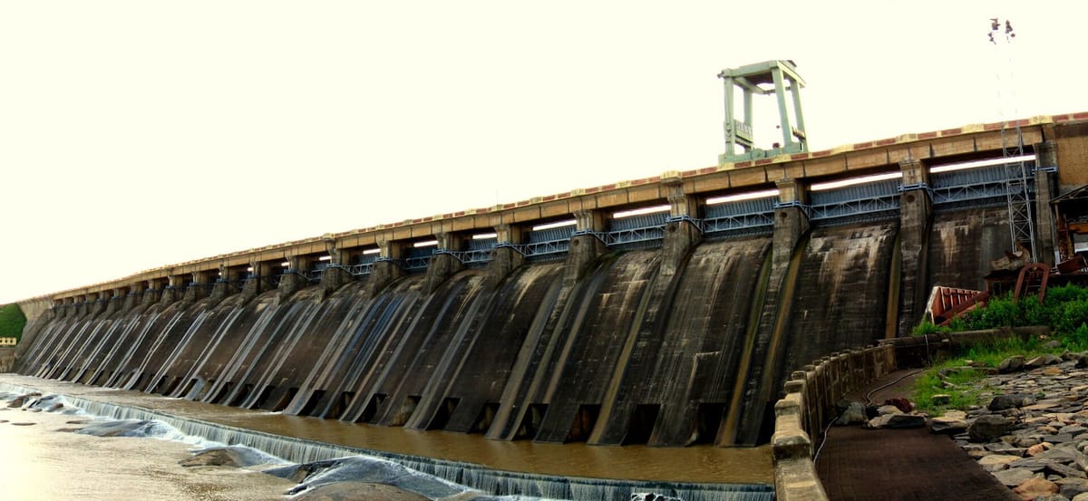
| Mahanadi | Highlands of Chhattisgarh | Bay of Bengal (Odisha) | Hirakud dam; forms a delta |
| Godavari | Nashik, Western Ghats | Bay of Bengal (Andhra) | Largest peninsular river; 'Dakshin Ganga' |
| Krishna | Near Mahabaleshwar | Bay of Bengal (Andhra) | Tributaries Tungabhadra, Koyna, Bhima; Nagarjuna Sagar |
| Kaveri | Brahmagiri hills, Kodagu | Bay of Bengal (Tamil Nadu) | Shivasamudram falls; Mettur dam |
| Narmada | Amarkantak, Madhya Pradesh | Arabian Sea (Gulf of Khambhat) | Flows west in a rift valley; Sardar Sarovar dam |
| Tapi (Tapti) | Betul, Satpura range | Arabian Sea (Gulf of Khambhat) | Surat stands at its mouth |
Dams, lakes and waterfalls
Rule in one line: learn each dam with its river — papers ask the pair.
| Dam / project | River | State |
|---|---|---|
| Bhakra Nangal | Sutlej | Himachal Pradesh – Punjab |
| Tehri | Bhagirathi | Uttarakhand |
| Hirakud | Mahanadi | Odisha |
| Sardar Sarovar | Narmada | Gujarat |
| Nagarjuna Sagar | Krishna | Telangana – Andhra Pradesh |
| Mettur | Kaveri | Tamil Nadu |
| Indira Gandhi Canal | Starts at Harike Barrage (Sutlej–Beas) | Punjab to Rajasthan |
- Wular (Jammu and Kashmir) — largest freshwater lake; the Jhelum flows through it
- Dal (Srinagar) — houseboats
- Chilika (Odisha) — largest salt-water lake
- Sambhar (Rajasthan) — salt is made from it
- Loktak (Manipur) — floating islands (phumdis)
- Kolleru (Andhra) — between the Godavari and Krishna deltas
- Jog — Sharavathi river, Karnataka
- Shivasamudram — Kaveri, Karnataka
- Dhuandhar — Narmada, near Jabalpur (MP)
- Hundru — Subarnarekha, Jharkhand
- Dudhsagar — Mandovi, Goa
- Kiliyur — Yercaud in the Shevaroy hills, Tamil Nadu
More facts that are asked onceTap to open
- The Pashupatinath Temple in Kathmandu, Nepal, stands on the bank of the Bagmati river.
- The Hoover Dam on the Colorado River, on the Nevada–Arizona border in the USA, is an Arch-gravity dam: it holds water both by its curve and by its weight.
- The Tehri dam on the Bhagirathi is India's highest dam.
- Ten Degree Channel separates the Andaman Islands from the Nicobar Islands. Kavaratti is the capital of Lakshadweep.
- The Aravalli (also spelt Aravalis) are the oldest mountains in India and among the oldest fold mountains in the world. Their highest peak is Guru Shikhar (1,722 m) at Mount Abu.
- Passes of the Western Ghats: Thal Ghat (Mumbai–Nashik), Bhor Ghat (Mumbai–Pune), Pal Ghat (Palakkad gap, Kerala–Tamil Nadu) and the Shencottah gap further south.
- The Narmada makes the Marble Rocks gorge and the Dhuandhar falls near Jabalpur.
Traps and practice
Last revision — where the options try to fool you.
- The Chenab rises near Baralacha La; the Beas near Rohtang. Do not swap them.
- Rivers rising outside India: Indus, Sutlej, Brahmaputra (all in Tibet). The Ravi, Beas and Jhelum rise inside India.
- Narmada and Tapi flow west and make estuaries; Mahanadi, Godavari, Krishna, Kaveri flow east and make deltas.
- Siachen is in the Karakoram (Trans-Himalaya), not in the Greater Himalaya.
- Wular is the largest freshwater lake; Chilika the largest salt-water lake.
- The Panjnad is made of five rivers that join the Indus — the Indus is not one of them.
- Anamudi (Western Ghats) is the highest peak of the peninsula; Mahendragiri is the highest of the Eastern Ghats.
Why do the Himalayan rivers flow all year while most peninsular rivers shrink in summer?
Show answer
Himalayan rivers get rain in the monsoon and melted snow from glaciers in summer. Peninsular rivers have no snow and depend only on monsoon rain.
- Chenab rises near
- Baralacha La
- Jhelum rises at
- Verinag
- Beas flows through
- Kullu valley
- Yarlung Tsangpo
- Brahmaputra
- Ganga is formed at
- Devprayag
- Hirakud dam
- Mahanadi
- Sardar Sarovar
- Narmada
- City at the mouth of the Tapi
- Surat
- Parasnath peak
- Chota Nagpur plateau
- Karewas grow
- Zafran (saffron)
- Six divisions: mountains, plains, plateau, desert, coasts, islands
- Himadri → Himachal → Shiwalik; Trans-Himalaya has the Karakoram and Siachen
- Bhabar → Terai → Bhangar (old) → Khadar (new)
- Western Ghats continuous and higher; Eastern Ghats broken and lower
- Sutlej from Rakas Tal (Kailash); Brahmaputra = Yarlung Tsangpo
- Ganga about 2,525 km; Sundarbans delta largest
- West-flowing: Narmada, Tapi — no delta
- Hirakud–Mahanadi; Sardar Sarovar–Narmada; Bhakra–Sutlej; Tehri–Bhagirathi